How just one of the B.C. wildfires compares to several Canadian cities
Here’s what one of the largest of the dozens of wildfires in B.C. looks like when superimposed over Canada’s biggest cities
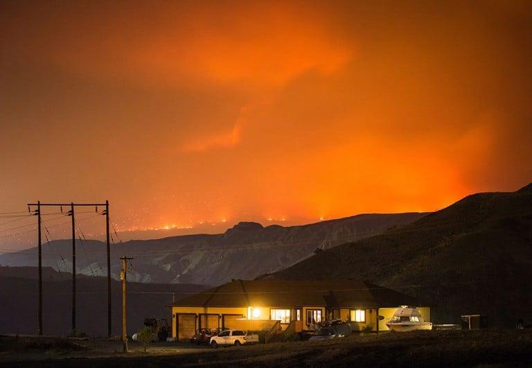
A wildfire burns on a mountain in the distance east of Cache Creek behind a house in Boston Flats, B.C., in the early morning hours of Monday July 10, 2017. (Darryl Dyck/CP)
Share
More than 14,000 people have been forced to leave their homes behind as close to 200 wildfires burn across parts of British Columbia. With the fires spread throughout the province, it can be hard to comprehend their scale.
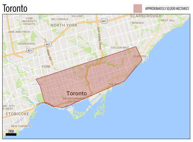
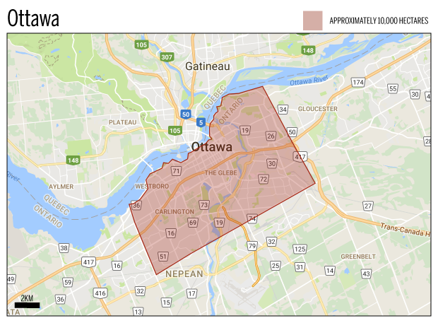
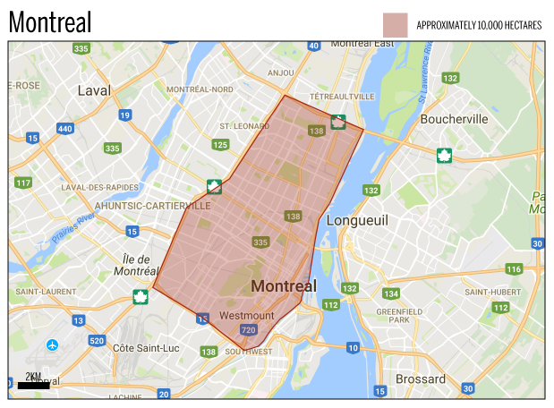
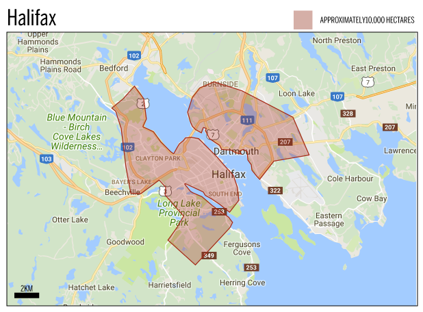
When the Fort McMurray fire started to spread, Maclean’s tracked it’s growth and superimposed the fire pattern on other Canadian cities to put it’s size in perspective. So for the current British Columbia wildfires, we’ve taken a similar approach.
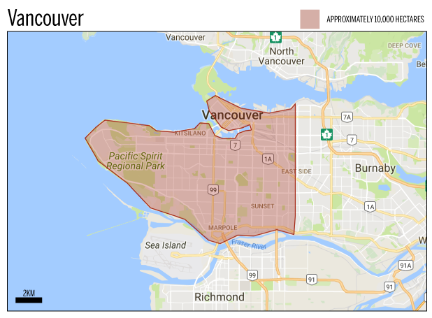
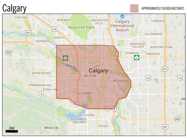
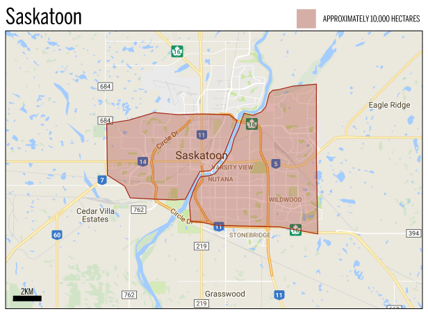
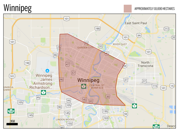
One of the largest wildfires is in the Ashcroft Reserve area. As of July 12, the fire had spread to approximately 10,600 hectares.
To give an idea of how big that is, here’s what 10,000 hectares would cover in several Canadian cities:
WATCH: A B.C. man describes fleeing his home during the wildfires
MORE ABOUT B.C. WILDFIRES:
- B.C. wildfires: Snapshots of the fires—and their aftermath
- B.C. wildfires: The race to save farm animals from the flames
- How you can help those affected by B.C. wildfires
- How many fires are burning in B.C.?
- B.C. creates $100 million fund as number of wildfires hits 230
- B.C. wildfires: a look at some of the big fires around the province
- B.C. wildfires lead to province-wide state of emergency
- Wildfire flares north of West Kelowna, B.C.
