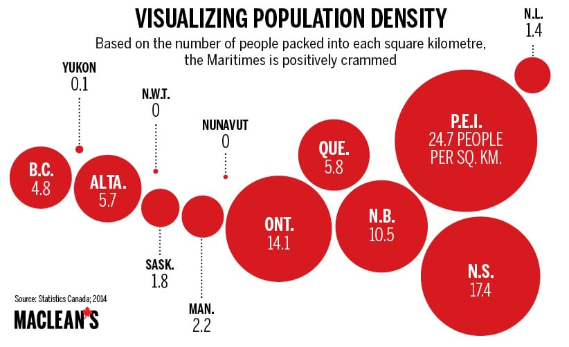
Mapped: Visualizing population density
The smallest province is also the densest
Share
Here’s a different way to look at Canada’s population. The circles represent the relative population density of each province. And yes, we know people do live in the Northwest Territories and Nunavut, but there are so few of them, and their geographies so vast, that you’d have to go a couple of decimal places before they’d register.
